


COPYRIGHT©2022 MUHANIT. ALL RIGHTS RESERVED. Designed by WebSite.co.kr
HOME >BUSINESS > NOTICE
NOTICE
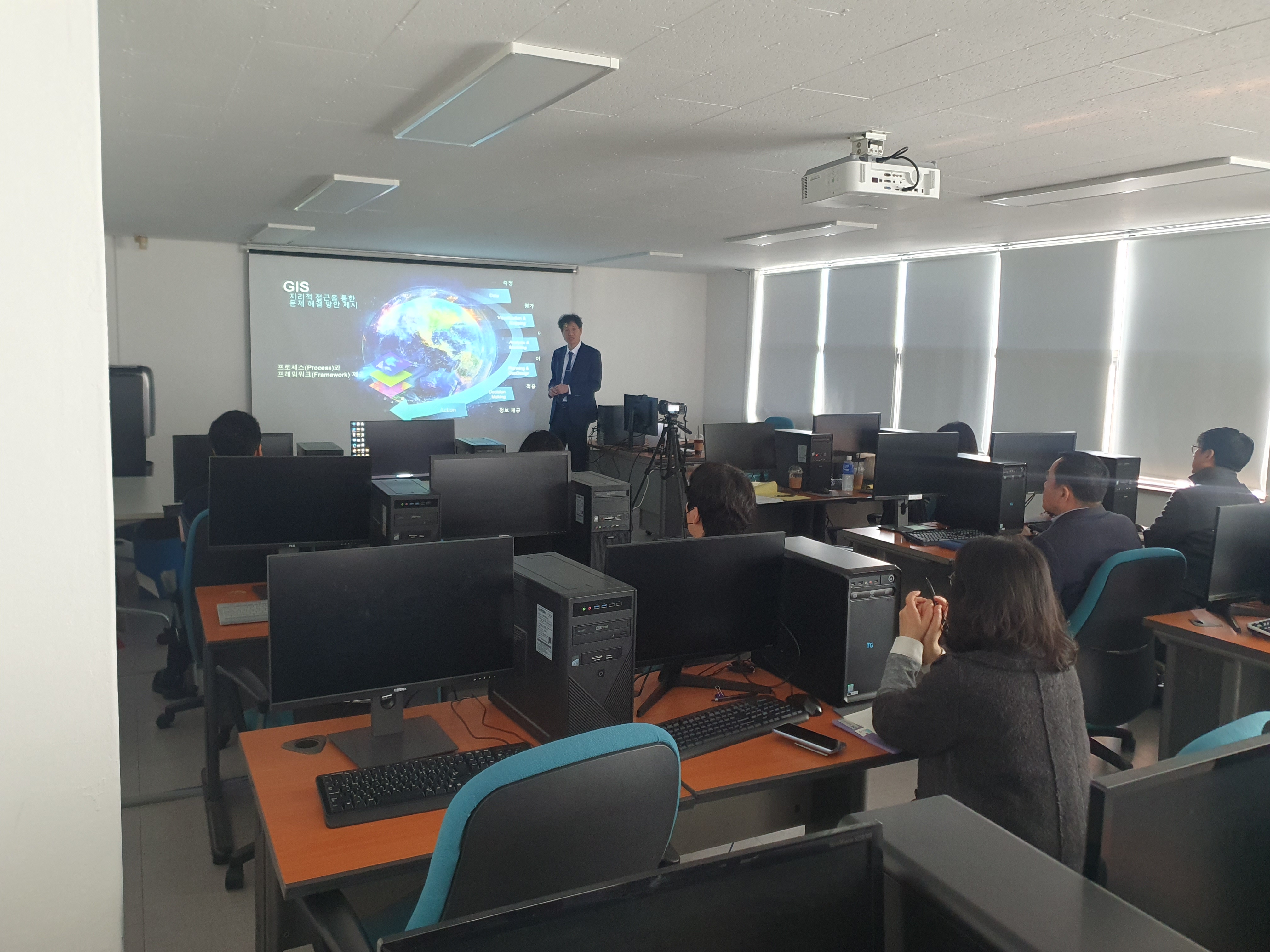
MuhanIT, News of the implementation of the "High-precision Electronic Map Construction Challenge Project in Goyang Special City" - ArcGIS Platform Training
마스터
2024-02-16
Number of views 9,683
On February 14, the computer education room of Goyang Special City conducted ArcGIS platform training for land information department managers and construction companies (SAMAH AERIAL SURVEY, MuhanIT) to utilize and expand high-precision electronic maps.
The training took place over two hours, and along with the introduction of the ArcGIS platform, any public official in Goyang easily produced web services through the platform and used 3D spatial information to focus on various simulation implementations needed for decision-making.
In order to improve the utilization of high-precision electronic maps in the future, we will periodically provide training to those in charge of Goyang City, and our consortium will periodically upload the collected data on the platform to provide services for anyone to use easily.
▶ Read More https://blog.naver.com/muhan_it/223355702250
MuhanIT CO.,
Registration # : 873-88-00217 CEO : KyungRok Bae, MyungHwa Lee
HQ : #706, 12, Dangsan-ro 2-gil, Yeongdeungpo-gu, Seoul, Republic of Korea Direction
Branch : 2th floor, 154, Pilmun-daero, Dong-gu, Gwangju, Republic of Korea
T. 02-6952-0825 F. 02-6952-0826 E. admin@muhanit.kr Privacy Policy
Registration # : 873-88-00217 CEO : KyungRok Bae, MyungHwa Lee
HQ : #706, 12, Dangsan-ro 2-gil, Yeongdeungpo-gu, Seoul, Republic of Korea Direction
Branch : 2th floor, 154, Pilmun-daero, Dong-gu, Gwangju, Republic of Korea
T. 02-6952-0825 F. 02-6952-0826 E. admin@muhanit.kr Privacy Policy
