


COPYRIGHT©2022 MUHANIT. ALL RIGHTS RESERVED. Designed by WebSite.co.kr
HOME >BUSINESS > NOTICE
NOTICE
[Patent card acquisition news] Land status analysis database construction technology (2022.03.16)
관리자
2022-03-28
Number of views 30,611
We are informing you of the patent acquisition of MUHANIT!
I obtained a patent for the data construction device and method for analyzing the land status on March 16
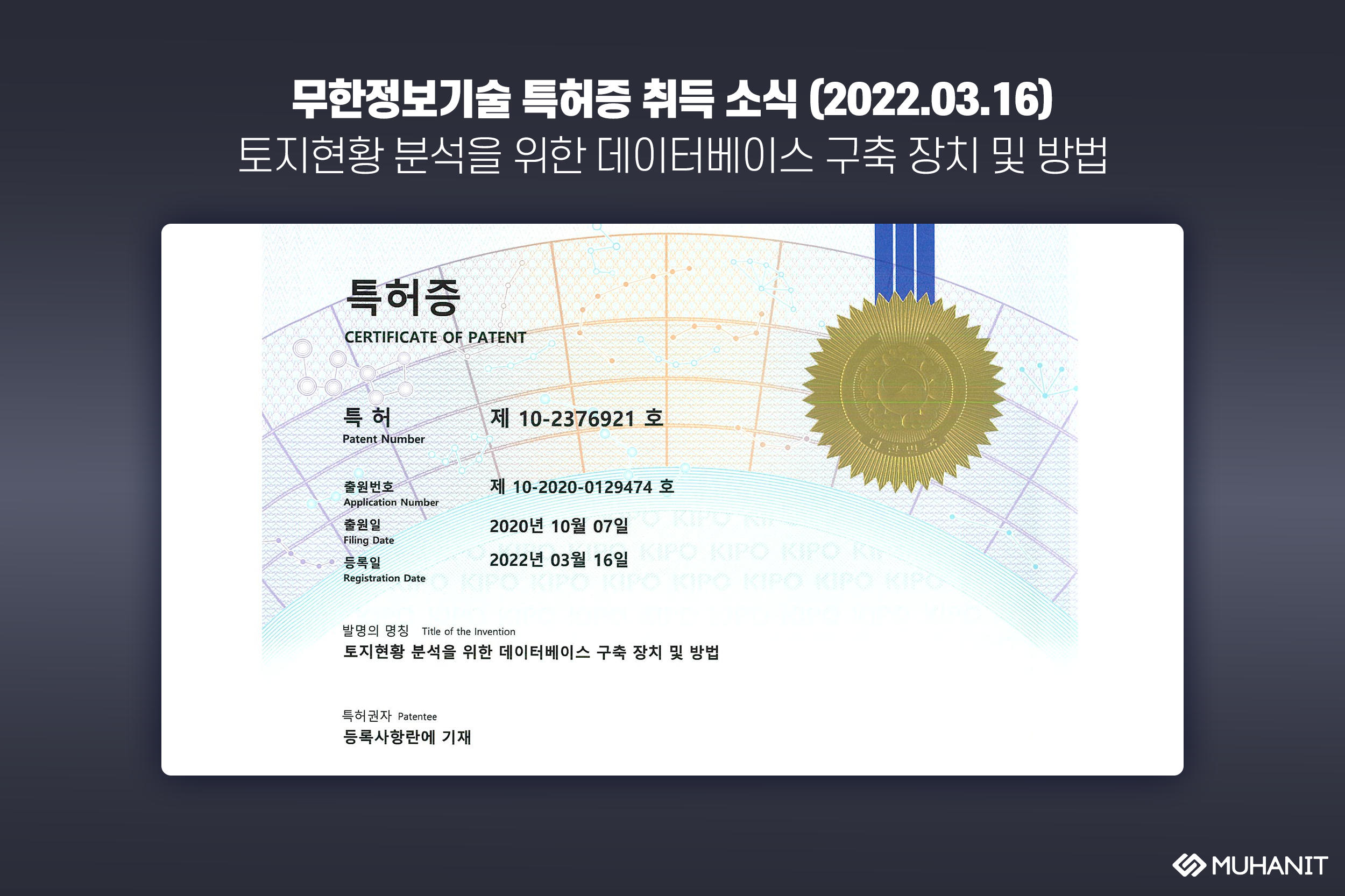
Patent Number
No. 10-2376921
Application Number
No. 10-2020-0129474
Filing Date
October 07, 2020
Registration Date
March 16, 2022
Title of the Invention
A database construction device and method for analyzing land status
Patentee
Korea Land Information Corporation / Changwon-city, Gyeongsangnam-do / Gino System / Aegis / MUHANIT Co., Ltd
<Patent contents>
MUHANIT _ Acquisition of patents related to database construction technology for land status analysis
─
It contains details on the database construction device and method for analyzing land status as follows.
1. Acquiring orthographic images of a particular area
2. Building a learning DB based on orthogonal images
3. Repeat the learning and verification process
4. Construction of <GeoAI>, an image reading model
<Effects>
MUHANIT _ Acquisition of patents related to database construction technology for land status analysis
─
1. It is possible to generate learning data for each classification item by extracting and processing images from satellite, aviation, and drone images
2. Improving the accuracy of image reading through repetitive machine learning and verification procedures for AI models
3. Automatically build read results into a database
4. It is possible to establish an automation system using high-definition images and artificial intelligence
5. Using this, it is possible to efficiently monitor state-owned property and monitor changes in national land use
─
MUHANIT Channel Shortcut (click the link below)
* Blog ▶ https://blog.naver.com/muhan_it/222682886577
* Facebook ▶ https://www.facebook.com/muhanit.kr/posts/3380074485553133
MuhanIT CO.,
Registration # : 873-88-00217 CEO : KyungRok Bae, MyungHwa Lee
HQ : #706, 12, Dangsan-ro 2-gil, Yeongdeungpo-gu, Seoul, Republic of Korea Direction
Branch : 2th floor, 154, Pilmun-daero, Dong-gu, Gwangju, Republic of Korea
T. 02-6952-0825 F. 02-6952-0826 E. admin@muhanit.kr Privacy Policy
Registration # : 873-88-00217 CEO : KyungRok Bae, MyungHwa Lee
HQ : #706, 12, Dangsan-ro 2-gil, Yeongdeungpo-gu, Seoul, Republic of Korea Direction
Branch : 2th floor, 154, Pilmun-daero, Dong-gu, Gwangju, Republic of Korea
T. 02-6952-0825 F. 02-6952-0826 E. admin@muhanit.kr Privacy Policy
